How AI can be used for satellite image processing to supervise power lines.
Introduction
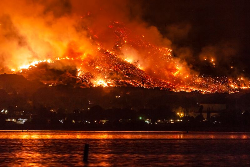
In just two weeks of 2018, The Camp Fire in Northern California destroyed more structures than the state’s other seven worst wildfires combined.
It broke out on November 8 and burned down the area of over 620 sq. kilometres. The pace the fire was spreading was staggering. Near midday of the very first day, it was burning the equivalent of more than one football field every second.
During California’s record-breaking 2018 wildfire season about 68 million tons of carbon dioxide were released into the atmosphere – equal to the emissions produced from generating one year’s worth of electricity in the state, or about 15 percent of California’s total annual emissions.
Climate change plays a major role
Long ago scientists projected that wildfires in the western United States will dramatically increase. Unfortunately that came true.
Five times more area has burned in wildfires in the past 30 years than ever recorded before.
“Science As A Contact Sport” by Stephen H. Schneider, 2009 edition.
According to experts, there’s an undeniable link between rising temperatures, droughts and climate change. Due to growing number of dried out trees, fires are getting wider and more dangerous.
“We’ve been lengthening fire season by shortening the rain season, and we’re warming throughout”
– Daniel Swain, a climate scientist at the University of California, Los Angeles, explained to National Geographic.
Between 2010 and 2017, the state of California was parched in an epic drought. 2018 and 2019 were also dry but additionally experienced high temperatures exceeding 40 degrees of Celcius in many parts of the state .
Wildfires are increasing in size, both in California and across the western U.S., says Park Williams, a fire expert at Columbia University. In the 2016 his group reported that since 1980’s, climate change contributed to an extra 40 thousand square kilometres of burning in western forests— an area about the size of Massachusetts and Connecticut combined.
High temperatures , low humidity and strong winds are favoring fire outbreaks and spreading, making it more difficult to fight at the same time. With the climate getting more extreme, we can expect it to happen again in the next years.
Could those fires have been avoided?
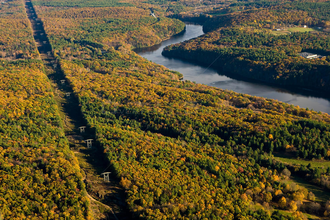
Aerial view of power lines cutting a swath through forest next to the Connecticut River in Gill, Massachusetts, USA, November 2007
The investigation revealed, that Camp Fire had two ignition points. Both of them were sparked by poorly maintained sections of powerlines that came in close proximity to trees, which in turn hit and damaged the line during a storm. So with better maintenance and keeping trees in right distances, some areas could have been saved.
However inspecting thousands of kilometers of powerlines is not easy. Traditional walking inspection or flying over with helicopters and drones is expensive and done too infrequently. Not only U.S. companies are finding it hard to do on a regular basis. It’s a global problem.
Apparently there is a way to do it cheaper, more frequently and on much bigger scale. Swedish startup Spacept claims that is able to provide “AI-powered infrastructure security from space”.
“We fuse satellite images with AI to prevent power outages and fires sparked by falling trees and storms. Our solution saves lives and reduces CO2 emissions while also radically reducing time and cost for infrastructure inspection”
The idea was simple – to monitor areas around utility lines and to alert about bushes, trees and other vegatation being too close.
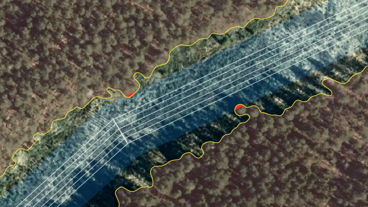
Visualization of the idea behind Spacept’s solution
Read the full article here