Introduction
Rising sea levels in Atafona currently leaves little hope to save the houses and businesses along its coast that have fallen victim to erosion. For instance, around 7,000 residents have been repeatedly forced to move inland, only to be displaced again when the waves reach their new homes. As these locals have a deep connection with the land and its history, they are less willingly to leave for good.
However, there is hope for the residents of Atafona. After years of fighting for help, families who have been displaced due to erosion impacts will now receive support from the local government. With a monthly payment of 1.2 thousand Brazilian Real (around 215 USD) a year, the local government has further decided to set up public housings for those affected.
Gaining insights the Future Events
As sea levels are rising globally, many coastal communities are facing an uncertain future. In fact, the latest IPCC report estimated a sea level rise of up to 0.84m by 2100, putting 410 million people at risk of displacement.
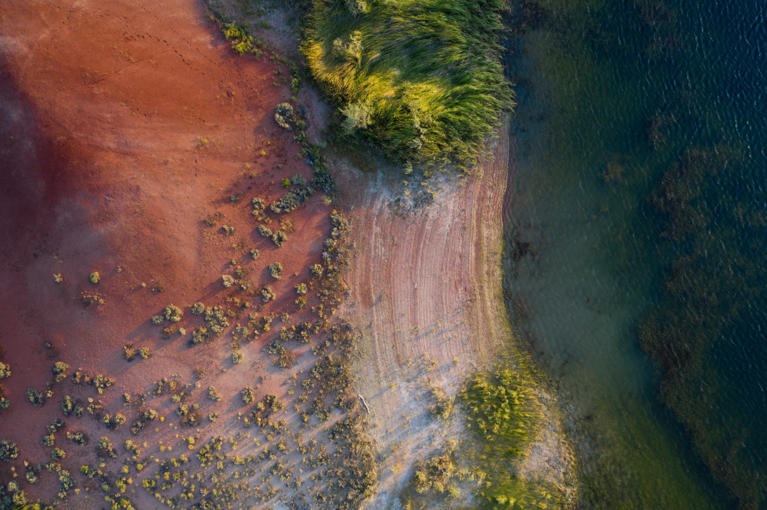
However, in Atafona, located along the South-Eastern coast of Brazil, these grim predictions are already a reality. Founded in 1622 by fishermen, the city has since become a popular tourist destination. Fast forward today, many hotels, restaurants and clubs have been destroyed and washed away.
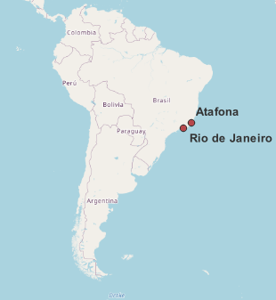
Location of Atafona and Rio de Janeiro along the South-Eastern Coast of Brazil.
Early Signs of Erosion
The first signs of erosions were shown in the 1960s. The river Paraiba do Sul was redirected to bring fresh water to the metropolitan region of Rio de Janeiro. Consequently, beaches and riverbeds along the coastal delta to not receive mineral rich sediments from the river that helped stabilize its soil.
Since the 1960s, the area has been fighting rising sea levels and coastal erosion caused by the Atlantic Ocean. As the shoreline moves inland an average of 3m every year, a total of 500 homes have been lost to the sea over the past 60 years.
Furthermore, additional strain was put on the beaches through the logging of the coastal mangrove forest, one of the important natural barriers to prevent coastal erosion.
Detecting Erosion from Space
With the erosion impacts being so severe, they can be seen from space. Thus, a Swedish startup- Spacept, combines the analysis of satellite imagery with cutting-edge artificial intelligence (AI) technologies to detect erosion impacting these infrastructures.
Spacept was founded in 2019 with a focus on vegetation monitoring to aid with the early detection of encroachment into power-line corridors. In addition, Spacept developed algorithms that help with infrastructure management. Specifically, they monitor and detect changes in imagery and identify objects such as buildings and trees to prevent potential hazards.
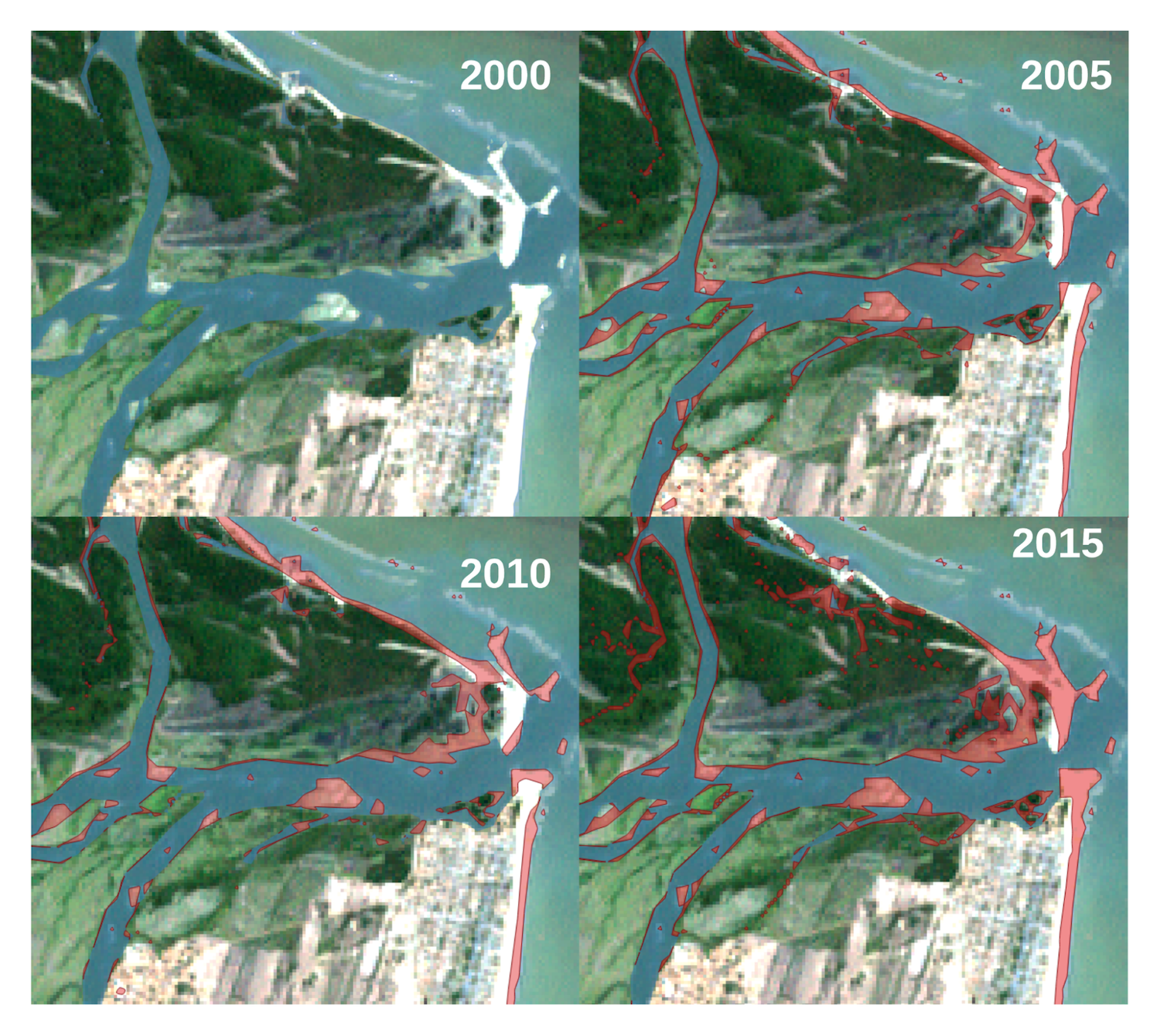
Satellite image showing coastal erosion 2000 – 2015 along the Atafona Shoreline and the Paraiba do Sul river; Landsat and Sentinel 2 Imagery used for delineation of the shoreline.
The Analysis
Looking at the analysis of Landsat and Sentinel-2 satellite imagery retrieved between 2000 and 2020, there is a total loss of 0.75 km2 in the region of Atafona alone. When applying very high resolution imagery, the extent of the destruction becomes even more evident.
The two satellite images shown are recorded between June 2015 and December 2020 by the satellite constellation SPOT. SPOT imagery is recorded at a resolution of 6m and allows for the delineation of objects as small as houses and trees.
Items highlighted in purple are the houses detected by a Building Detector tool developed combined with manual augmentation developed at Spacept. As a result, the data shows a significant land loss along the shore within 5 years as well as the destruction of an entire housing block in the centre of the image.
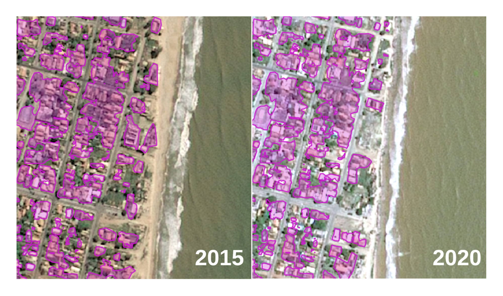
Comparison between 2015 and 200 shoreline and built-up structures in Atafona. Shown in purple are the buildings detected by the Spacept Building detector in combination with manual augmentation. Imagery: SPOT, recorded 10 June 2015 and 15 December 2020.
The Mechanics of Computer Vision Applied to Satellite Imagery
The detector utilizes an AI algorithm in the form of a Convolutional Neural Network to detect buildings. Thus, AI and remote sensing based solutions like our building detector can be particularly useful even in more acute cases like earthquakes or floods.
A majority of analysis on satellite imagery is performed at medium resolution of around 10-20 cm. However, Spacept’s in-house model for object detection are fine-tuned at resolutions up to 50cm. In action, these models can help identify objects as small as individual houses, shown in the analysis above. When using satellite imagery, an area can be analyzed within minutes. Therefore, local governments can quickly dispatched resources to places where it is needed the most. This allows them to save time, money and reaching those in need of help faster.
Conclusion
As global temperature rises, average sea levels are predicted to increase in many coastal regions. The analysis of multi-temporal satellite performed by Spacept can provide valuable insights on coastal erosion on infrastructures. Furthermore, these data can help countries prepare in mitigating the damaging effects. Lastly, such observations also show that other coastal communities worldwide can also benefit from using technology to protect infrastructures being at risk due to climate change.
Learn more about Spacept
Spacept is a Swedish startup with solutions that lie at the intersection of infrastructure inspection and climate change management. The solution aims to modernize infrastructure inspection by fusing machine learning techniques and satellite imagery together, providing key insights to infrastructure operators.
Our main product is an inspection solution for above-ground transmission and distribution lines. In addition, we also have other products for oil and gas pipelines, street lights, railways, buildings, and roads.
Our trailblazing work in Geographic Information Systems (GIS) has been recognized by Copernicus, the European Space Agency (ESA), Digital Tech 50 (DT50), the Swedish government, Google’s SDGs Startup Accelerator, and Oslo’s Innovation Week.
Our technological expertise has led us to become one of the most innovative Swedish based AI companies at Futurology. Furthermore, we are one of the most promising companies impacting the ASEAN energy ecosystem in Initiate’s Future of Energy Start-up Challenge in Asia.