Introduction
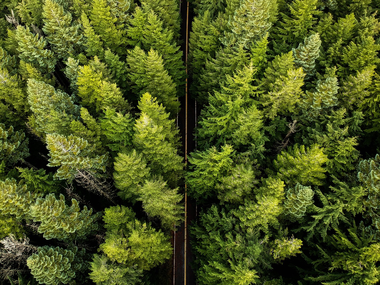
Vegetation is a significant source of outages for many utilities. In some regions, one quarter to one half of all outages can be attributed to it. However, vegetation encroachment has also been the cause of the massive Northeastern United States outage in 2003.
With the growing incidence of extreme events, power lines vegetation management is becoming increasingly crucial in tackling potential fire hazards and securing infrastructure resilience. As the traditional approach involves helicopters and ground crews, it has become a time consuming and costly process. Although drones have been used to reduce the cost of data collection, it still remains expensive.
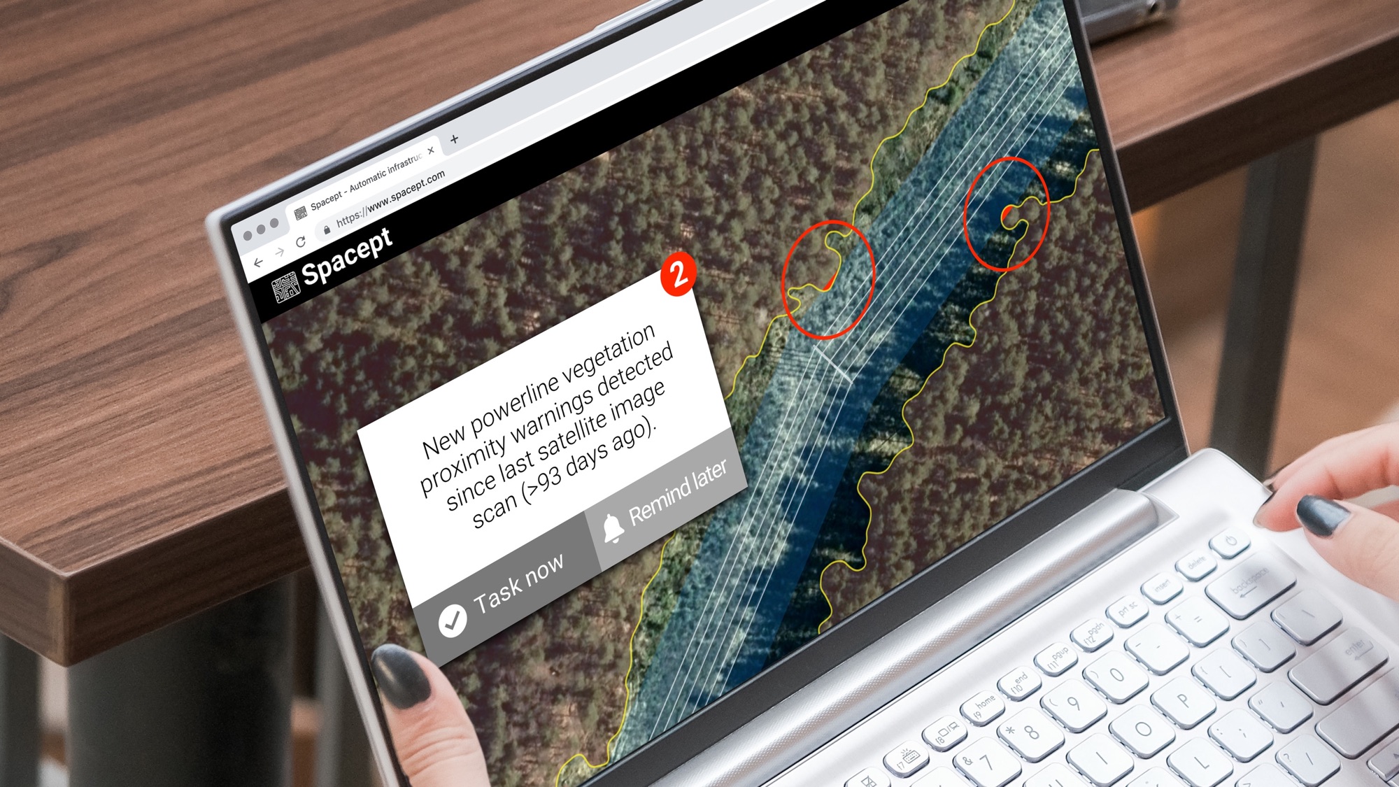
Now, an innovative Swedish startup called Spacept is using satellite imagery together with deep learning to identify high risk areas of vegetation encroachment. By applying machine learning algorithms to high resolution satellite imagery, we can distinguish vegetation from other objects. Specifically, we can differentiate trees from grass and bushes. But most importantly, we can identify trees being at risk of encroachment.
Through comparing a drone-based approach with the satellite imagery methodology, the second option is determined to be more accurate. Furthermore, it is significantly less costly than conducting through a drone-based process.
Background
Power line inspections for vegetation management are essential in ensuring grid reliability and resilience. However, they are generally performed by manned helicopters or by a ground crew.
Within the process, data is collected by cameras and analyzed to detect diseased trees that could fall and hit a power line (fall ins). In addition, they can detect trees that are encroaching on power lines (grow ins). These inspections are mandated by NERC in North America. As an example, Beyond visual line of sight (BVLOS) drones have reduced the cost of collecting line inspection data.
Not only does Spacept’s high resolution satellite imagery technology reduces cost, we also help cut down the time process. In other words, we reduce the the total length of power line that requires more detailed inspection with drones, helicopters, or ground crews
Evolving machine learning models at Spacept
In consideration of the current challenges, Spacept, has developed a vegetation management solution that applies machine learning models to multi-band satellite imagery. The solution automatically identifies high-risk areas for vegetation encroachment on above-ground transmission and distribution lines anywhere on the planet.
In addition, Spacept develops its own in-house training data for machine learning models, enabling follow-up ground inspections of high-risk areas to develop pruning and other response programs. Ultimately, the training data is constantly enhanced with feedback from new projects for continuous improvement of the models.
Satellite-based vegetation encroachment risk assessment
The key business benefit of Spacept’s solution lies in its automation process. As the traditional process requires ground-based inspection such as helicopter, drone-based, or ground crew, Spacept’s methods is more time and cost effective.
Specifically, Spacept’s satellite-based technology makes it possible for power grid operators to monitor vegetation encroachment over their entire infrastructure in a cost-effective manner. By applying the most recent and highest resolution (0.50 – 0.30 cm) satellite imagery, it fully satisfies the requirements for vegetation encroachment detection. Thus, Spacept’s approach makes it possible to monitor hundreds of thousands of kilometers of power lines every year in any place in the world.
Spacept’s vegetation management platform
Workflow
Currently, the workflow of identifying and downloading satellite imagery, applying machine learning for feature identification, and the assignment of risk categories to individual trees is a semi-automated process.Ultimately, the long term objective is to reduce the manual intervention and achieve an end-to-end automated workflow. In addition, the current workflow proceeds from a geographical layout of the power line to be inspected in the form of a standard GIS file.
The most recent available high resolution satellite images satisfying certain criteria are identified and downloaded from data providers. The criteria typically include panchromatic and multi-spectral bands, resolution of at least 50 cm, vegetation capture with leaf on, and minimal cloud coverage. The downloaded images are fed to the current vegetation model which automatically extracts features and distinguishes trees from other man-made and natural objects. One of the important capabilities of the model is that it is very efficient in differentiating trees from bushes.
After the automated processing, the imagery and labelling are reviewed by experienced assessors and make corrections to the labelling for problem areas. An example is cases of visually distinguishable bushes or edges of trees. After the labelling step, the distance between each tree and the power line is calculated and a risk category is assigned using risk categories provided by the client. The final delivery is a GIS file with the location and the corresponding risk categories assigned to the trees.
In-field case study
To assess the potential benefits of satellite-based analysis, Spacept partnered with Sterblue, an infrastructure health management platform. This allows us to apply their satellite-based power line vegetation management solution for a French power operator grid through thousands of kilometres.
Within the process, Spacept applied their algorithms to selected satellite imagery, generatingg a risk file for the targeted grid segment. Sterblue then assigned emergency (risk) levels based on the distance from the power line using a classification of emergency levels provided by the grid operator.
Afterwards, Sterblue carried out in-detail inspections of at-risk areas with its drone inspection fleet. Following, a ground inspection team was sent to verify the physical trees’ locations, resulting to 283 locations identified. Ultimately, vegetation at each location was manually validated and was compared with the satellite predictions.
The key business benefit take away of the satellite imagery-based analysis is that it was able to identify all the trees that the subsequent ground inspection identified as at risk.
In a real-world scenario, applying the satellite imagery analysis as a first step in a power line inspection would dramatically reduce the area and trees that would require ground-based inspection using helicopter or drone-based inspection. As a result of this process, Sterblue reduced its operating costs by 80%.
A more detailed analysis of the satellite data attempted to classify trees into detailed emergency levels U0 to U3. Comparing this analysis with Sterblue’s classification was used to create a “confusion matrix” showing instances of agreement and disagreement between the two analyses. It was found that there was good agreement between the satellite and ground-based inspections and analyses.
Conclusion
Several companies have recognized that earth observation imagery is of limited value without the application of analytics to interpret the data. For example, Spacept is applying analytics to the huge amount of earth observation data to provide a valuable high risk vegetation encroachment detection service that is safer, faster, and less costly than ground-based approaches to transmission and distribution line vegetation monitoring.
Learn more about Spacept
Spacept is a Swedish startup with solutions that lie at the intersection of infrastructure inspection and climate change management.The solution aims to modernize infrastructure inspection by fusing machine learning techniques and satellite imagery together, providing key insights to infrastructure operators.
Our main product is an inspection solution for above-ground transmission and distribution lines, but we also have other products for oil and gas pipelines, street lights, railways, buildings, and roads.
Our trailblazing work in Geographic Information Systems (GIS) has been recognized by Copernicus, the European Space Agency (ESA), Digital Tech 50 (DT50), the Swedish government, Google’s SDGs Startup Accelerator, and Oslo’s Innovation Week.
Our technological expertise has led Spacept to become one of the most innovative Swedish based AI companies at Futurology. In addition, we are listed as the most promising companies impacting the ASEAN energy ecosystem in Initiate’s Future of Energy Start-up Challenge in Asia.