Introduction
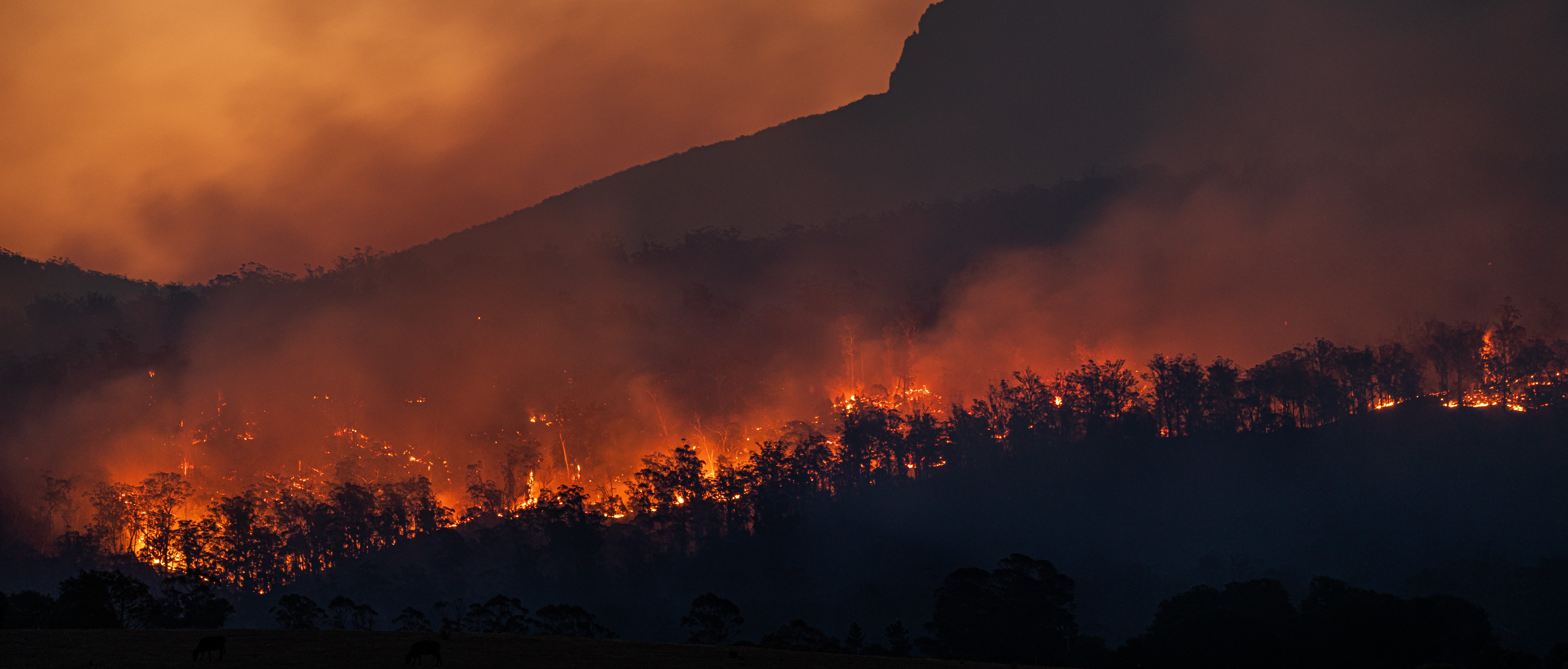
Wildfires have become an increasingly regular occurrence across the world, from Greece and Turkey to Australia and California. Causes vary from stray cigarettes, unextinguished campfires, lightning strikes, and especially in California, damaged power lines.
The recent Dixie Fire, started on July 13th by a tree falling on PG&E power lines, has grown to become the single largest fire in California history at 919,299 acres by September 2021. When it comes to PG&E’s current vegetation inspection and management methods, it is increasingly important that it achieves access to scale.
About PG&E
Since, PG&E is indebted to various lawsuits between the wildfires of 2015, 2017, and the 2018 Camp Fire that consumed the town of Paradise. In response, the company filed for Chapter 11 bankruptcy in hopes of avoiding anticipated tens of billions of dollars in additional liabilities.
Concluding with a Plan of Reorganization, PG&E arrived out of bankruptcy. This plan was approved by the California Public Utilities Commission (CPUC) and the United States Bankruptcy Court for the Northern District of California. Ultimately, PG&E has laid out a commitments to a $25.5 billion settlement for all major wildfire victims and groups, along with changes to its Board of Directors.
Currently, PG&E’s vegetation management protocol consists of year-round tree clearances using traditional methods. After the land or homeowner is notified of an upcoming inspection, inspectors will manually mark trees that require pruning or removal. It could take up to 4 to 6 weeks for marked trees to be taken care of accordingly.
Managing Vegetation
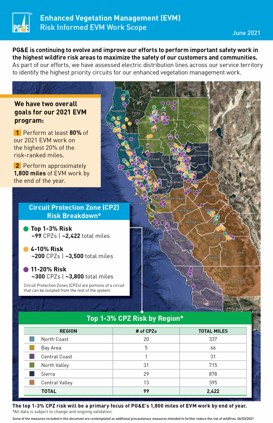
As part of the Plan of Reorganization, the CPUC created an enactment of measures to strengthen PG&E’s governance and operations. One of these measures includes the Enhanced Vegetation Management (EVM) program to reduce wildfire risks.
While PG&E continues its vegetation management protocol, it will also account for potential risks from trees that are dead or dying, have overhanging limbs, or are too tall.
Lastly, the company’s main goal is to complete 1,800 out of 2,400 miles of EVM by the end of 2021. The utility identified Circuit Protection Zones (CPZ) as the center of focus for the top 20% of areas with the highest wildfire risk.
The top 20% are portioned into areas of risk from 1-3%, 4-10%, and 11-20%, with the top 1-3% being the main focus for their 1,800 EVM miles. Just the 1-3% cover an estimate of 2,422 miles with the other risk areas estimated to be 3,500 and another 3,800 total miles.
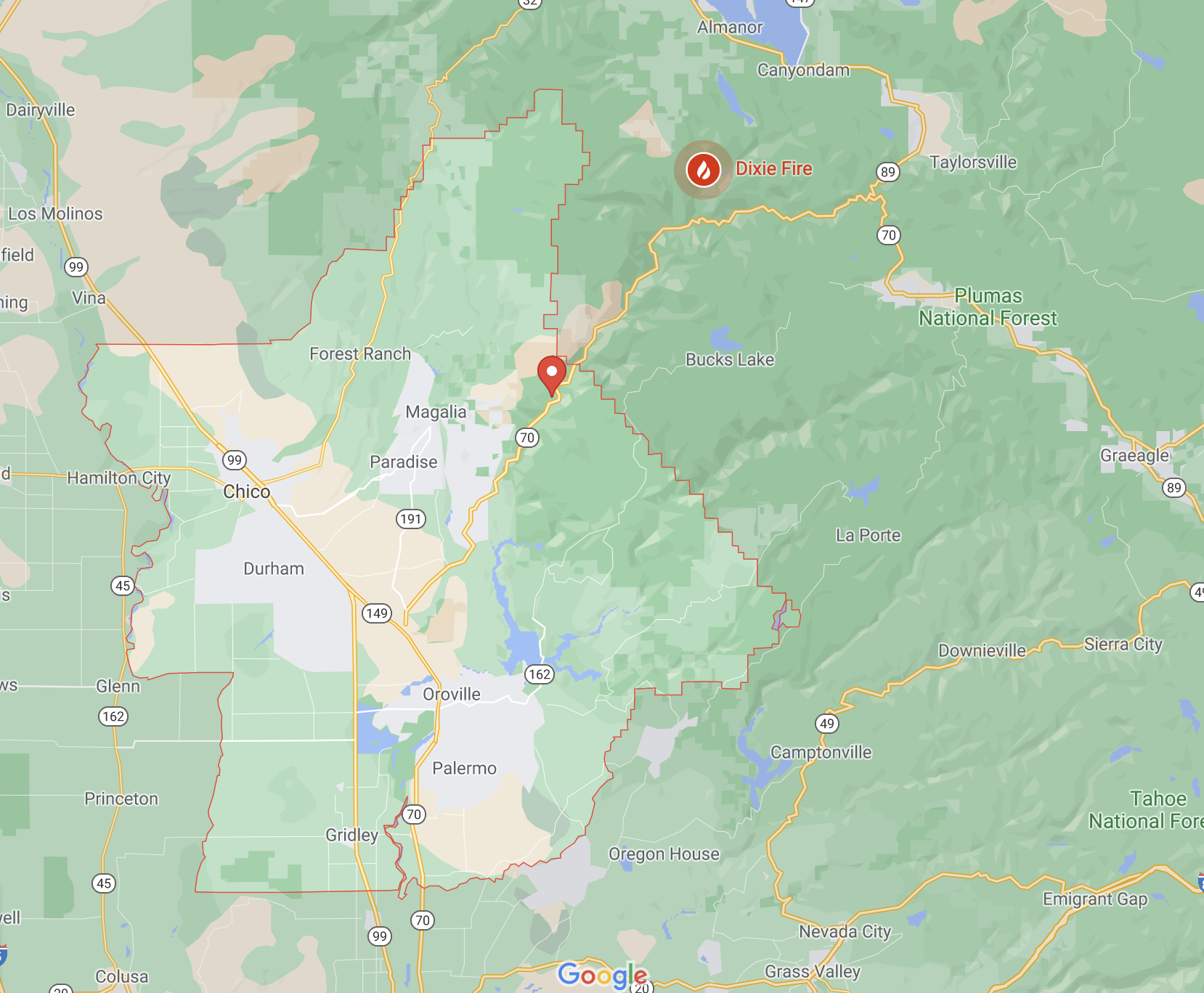
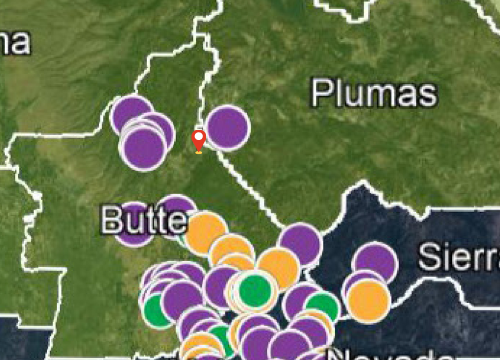
Comparing the origin of the Dixie Fire from sources like the San Francisco Chronicle, Google Maps, and the map provided by PG&E. It is apparent that the Dixie Fire is only near CPZs with a risk of 11-20%. The likelihood of PG&E carrying out its EVM program this year in the Dixie Fire region is very low.
Detecting Vegetation Encroachment from Space
In recent years, California droughts have been more intense and lasting longer with each period. However, there is not much leeway for wagering between what provides the most risk. In this case, access to information and the speed of these operations needs to match its scale.
Here at Spacept, we are interested in seeing if our tools could spot the vegetation hazards that caused the Dixie Fire. By being able to detect encroachment, we can prevent future hazards and increase utility reliability.
To determine this, we pulled satellite data taken on June 15th by the SPOT Satellite. We focused on the area pinpointed by the San Francisco Chronicle as the likely starting point. The fire is reported to have begun near Feather River Canyon on Dixie Road.
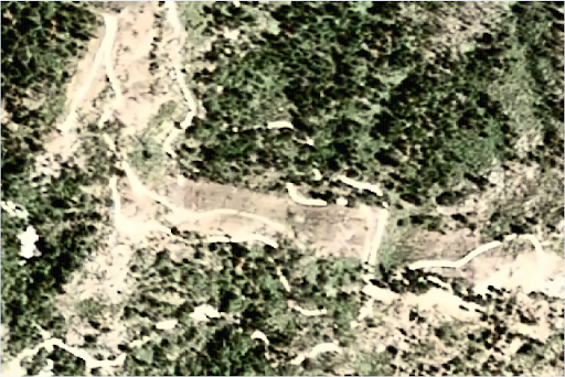
Then, we applied our Tree Detector to the satellite image to find any tree or vegetation encroachment on the path cleared by PG&E surrounding the power lines.
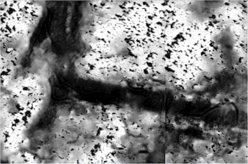
Our tree detector found certain levels of overgrowth on the path of the power lines.
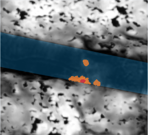
Zooming in to one part of it and placing a mask detecting the power line’s path and the vegetation, we generated an image of one such area of dangerous overgrowth.
Analysis
In the image, the blue path represents cleared sections of the power line’s path. The red represents the levels of high tree and vegetation density and the orange represents medium levels of vegetation density.
Given PG&E’s recommendation that treelines of heights under 40 feet be no closer than 15 feet from power lines, we found several areas of high concern that breached such protocols in this area.
In future situations, PG&E and other power companies could use satellite-based solutions like those at Spacept to identify such overgrowth beforehand and direct vegetation management resources to those areas.
Conclusion
In conclusion, in California where wildfires are especially frequent and devastating, any decrease of cases could prevent the destruction of crucial ecosystems and infrastructure. Furthermore, it could also save such companies with billions of dollars in lawsuits. The hurdles of scalability and the operations to initiate an inspection need improved management foresight. Satellite analysis is a feasible, proactive approach and presents accelerated results for vegetation management. To see more on how our solutions can help prevent such disasters, check out our website at spacept.com.
This case study was originally published on TechCrunch.
Learn more about Spacept
Spacept is a Swedish startup with solutions that lie at the intersection of infrastructure inspection and climate change management.The solution aims to modernize infrastructure inspection by fusing machine learning techniques and satellite imagery together, providing key insights to infrastructure operators.
Our main product is an inspection solution for above-ground transmission and distribution lines, but we also have other products for oil and gas pipelines, street lights, railways, buildings, and roads.
Our trailblazing work in Geographic Information Systems (GIS) has been recognized by Copernicus, the European Space Agency (ESA), Digital Tech 50 (DT50), the Swedish government, Google’s SDGs Startup Accelerator, and Oslo’s Innovation Week.
Our technological expertise has led Spacept to become one of the most innovative Swedish based AI companies at Futurology. In addition, we are listed as the most promising companies impacting the ASEAN energy ecosystem in Initiate’s Future of Energy Start-up Challenge in Asia.